Unveiling the Secrets of Bat Behaviour: The Advantages of Using GPS Tags
Posted: 20 June, 2024

In this blog, we hear from Irish Research Council DOROTHY MSCA COFUND awardee Dr Frédéric Touzalin on his pioneering research on the nocturnal movement of bats.
Bats are known reservoirs for various zoonotic diseases such as Enteropathogenic Bacteria (Salmonella, Shigella, Yersinia, and Campylobacter) and viruses, including nipah virus, hendra virus, ebola virus, SARS coronavirus, making the study of their movements crucial for understanding disease transmission dynamics. Global Positioning System, (GPS) tracking provides comprehensive data on bat movements and interactions, which can be used to model the spread of diseases such as rabies and coronaviruses. By understanding how bats move between habitats and come into contact with other species, researchers can better predict and manage potential outbreaks. This information is vital for public health planning and can inform measures to reduce the risk of disease transmission to humans and livestock.
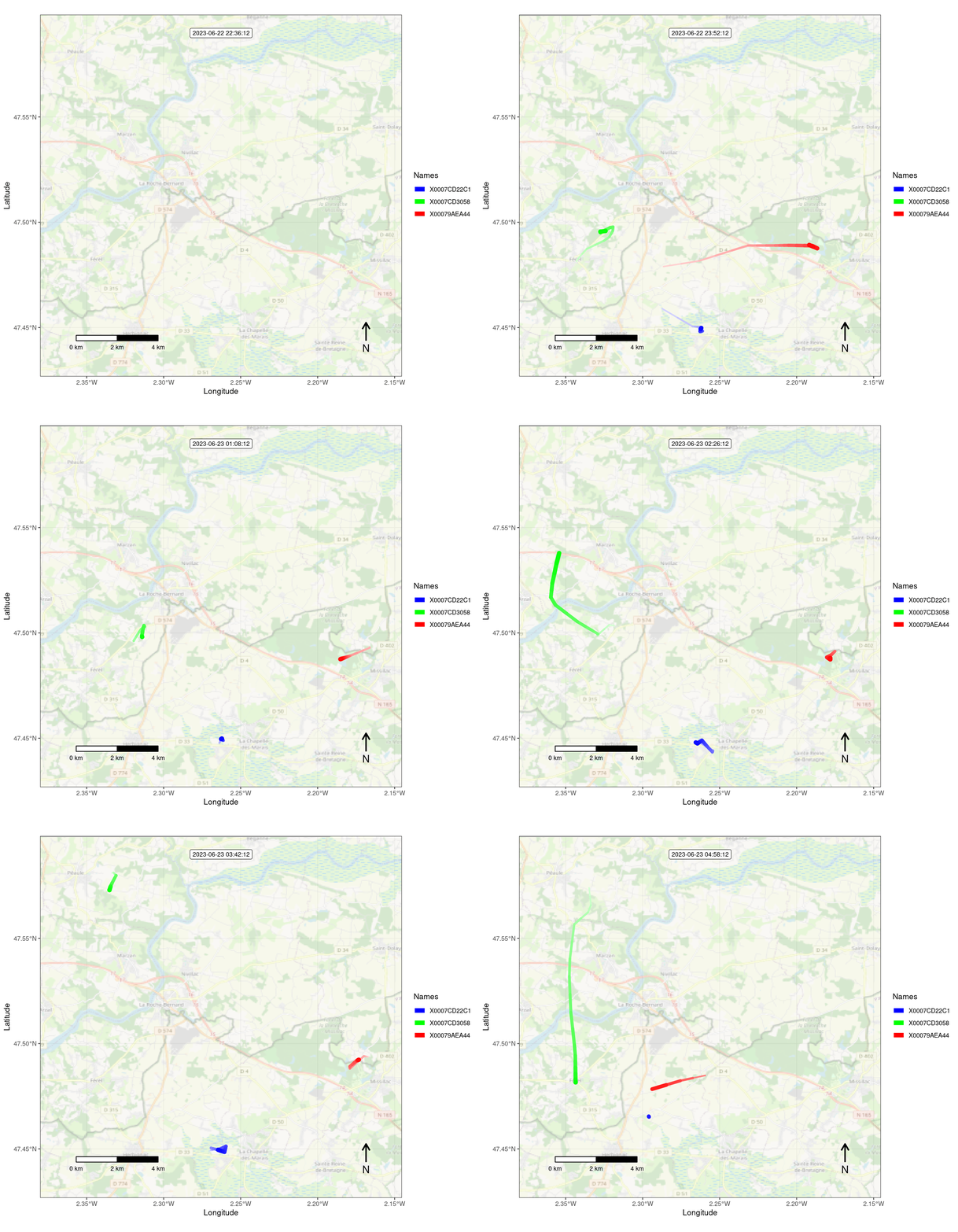
At the French National Bat Conference, held from March 7-10 in Bourges (France), Dr Frédéric Touzalin unveiled findings from a pioneering study on the nocturnal movements of Myotis myotis bats, tracked using miniature GPS tags. This biennial conference brings together over 400 attendees, including bat researchers, stakeholders, and policymakers from across France. The event commenced with a day dedicated to technical presentations for professionals, including NGO bat workers and policymakers. The subsequent two days were open to a broader audience, showcasing the latest research and conservation efforts from France and neighbouring countries. During the conference, Dr. Touzalin co-organised a workshop focused on the application of GPS technology in bat research. Drawing from experience, the advantages and limitations of current technologies highlighted the methodologies for deploying GPS tags on bats and the anticipated outcomes. Fred’s presentation was enriched with insights and findings from his own DOROTHY MSCA research project, providing a comprehensive overview of this cutting-edge field in bats.

Bats, often enigmatic in their nocturnal habits, have long intrigued scientists aiming to understand their complex behaviours and habitats. GPS tagging is a transformative tool in bat research, offering detailed insights into their habitat use, aiding in epidemiological modelling, and improving our understanding of roost connectivity. By providing precise data on bat movements, GPS technology helps protect these vital creatures and their ecosystems while also safeguarding public health. Recent advancements in GPS technology have revolutionized bat research, offering unprecedented insights into their movement patterns, habitat use, and roost connectivity, as well as the distances they travel and the barriers they encounter. GPS data reveals the specific areas bats frequent for foraging, roosting, and mating. It also enables us to get a better grasp of the impact of environmental changes and human activities on bat populations. This is why using GPS tags on bats is a game-changer in the study of these fascinating creatures. GPS tags allow researchers to track bats with remarkable precision, unlike traditional methods, such as radio telemetry. GPS technology provides detailed data on flight paths, foraging areas, and migration routes. This precision helps scientists understand the spatial dynamics of bat populations and their interactions with the environment. This knowledge is crucial for creating conservation strategies that maintain or improve connectivity between habitats, ensuring bats can safely access the resources they need. It also helps to design epidemiological models.

At the French National Bat Conference, Dr. Touzalin presented the preliminary results of a study in which thirteen big-eared bats from two separate bat maternities were fitted with 2.5 g PinPoint (Lotek) GPS tags. These tags recorded their position every four minutes, enabling data to be collected over 33 nights. He showed that hunting time was negatively correlated with distance from the colony, and that deciduous or mixed woodland, as well as grassland, particularly natural and grazed grassland, were the most popular habitats for hunting. Interestingly, the study shows that despite the relative proximity of the two roosts, there is no overlap of hunting areas between the two maternities. This suggests the need to maintain natural grasslands and deciduous forests for the conservation of the species, and that during breeding, maternities can be considered isolated from an epidemiological perspective.

Dr. Touzalin’s research is going to greatly improve our understanding of the movements of these fascinating creatures. The research has already shown the importance of preserving deciduous or mixed woodland, as well as grassland, particularly natural and grazed grassland. Conservation strategies should include enhancement and creation of new habitats.